Maps & Ariels
High-Impact Aerial Property Maps & Custom Real Estate Map Designs
Highlight your property’s location, surroundings, and selling points with professionally designed aerial maps and custom real estate graphics. At SPD, we turn ordinary aerial photographs into clear, visually striking marketing visuals that instantly communicate location value to buyers, investors, and stakeholders.
Whether for real estate marketing, development proposals, or investor presentations, our aerial maps are accurate, attractive, and ready for both print and digital use.
Why Choose Our Marketing Maps & Aerials?
- Visually Striking Designs – Beautifully rendered maps that grab attention in brochures, websites, listings, and presentations.
- Flexible, High-Quality Formats – Delivered in vector formats (AI, PDF, SVG) or high-resolution images, perfect for print and online use.
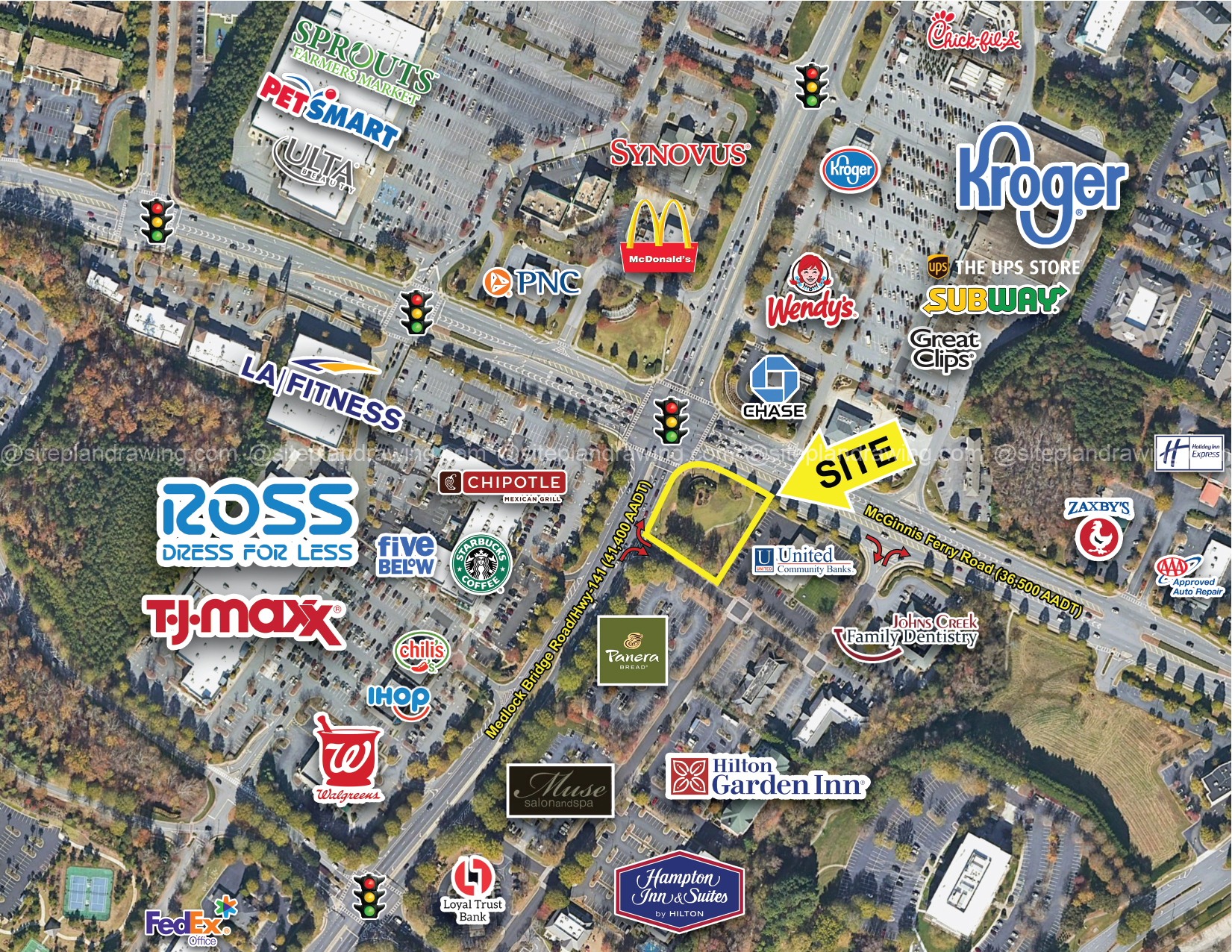
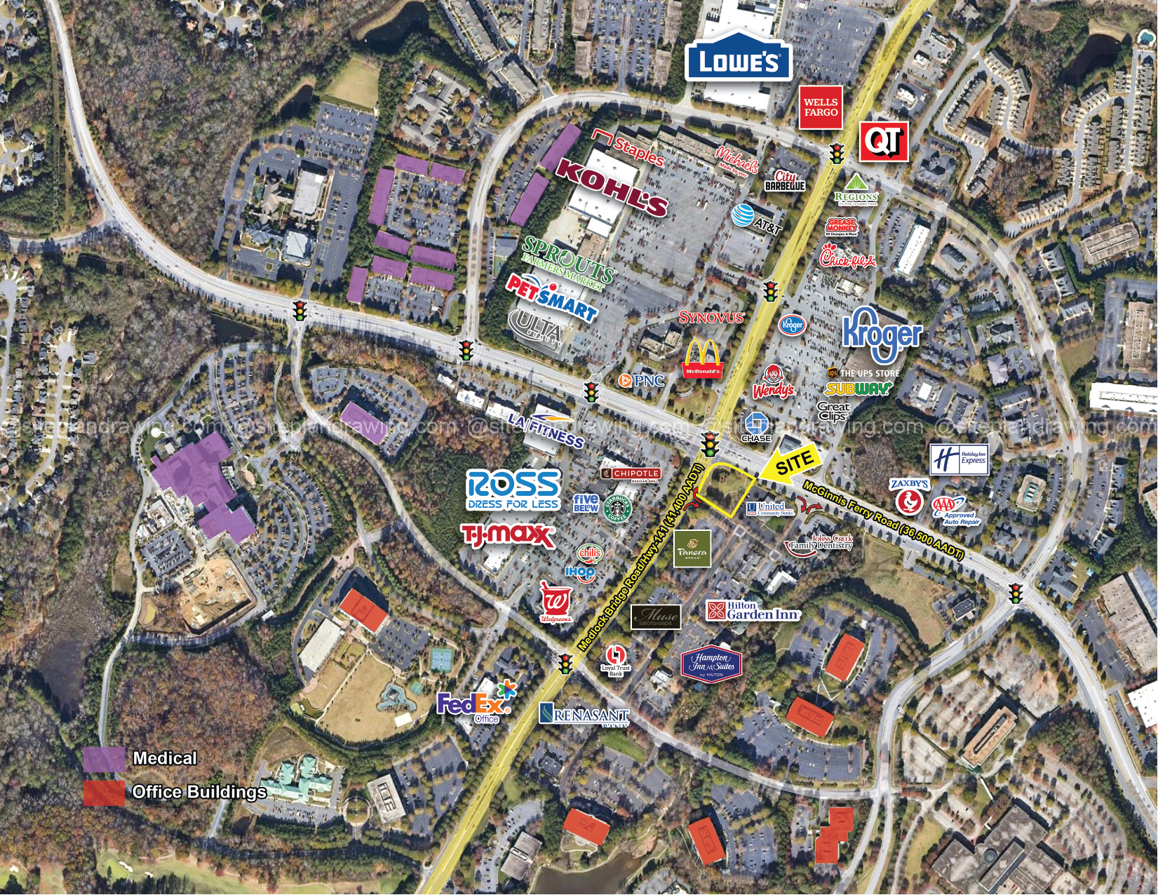
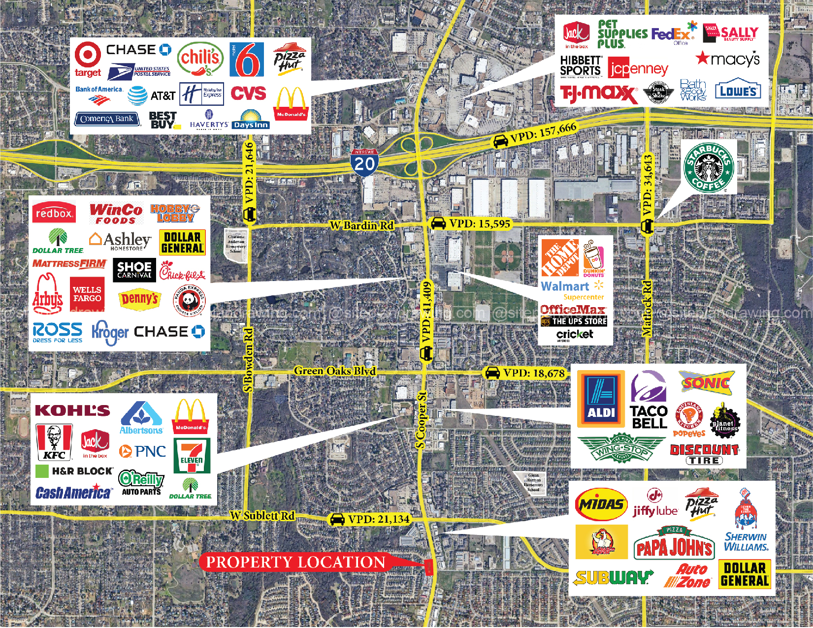
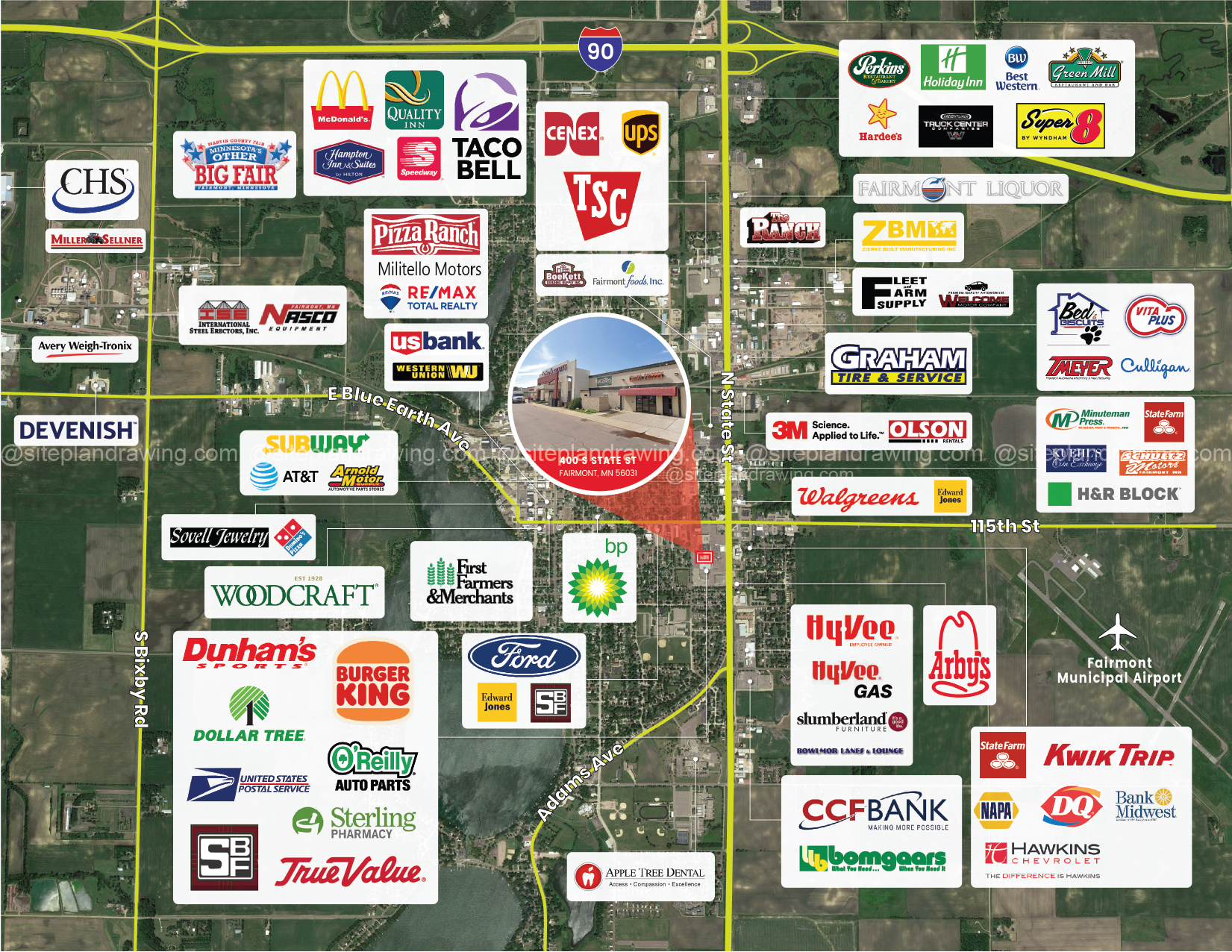
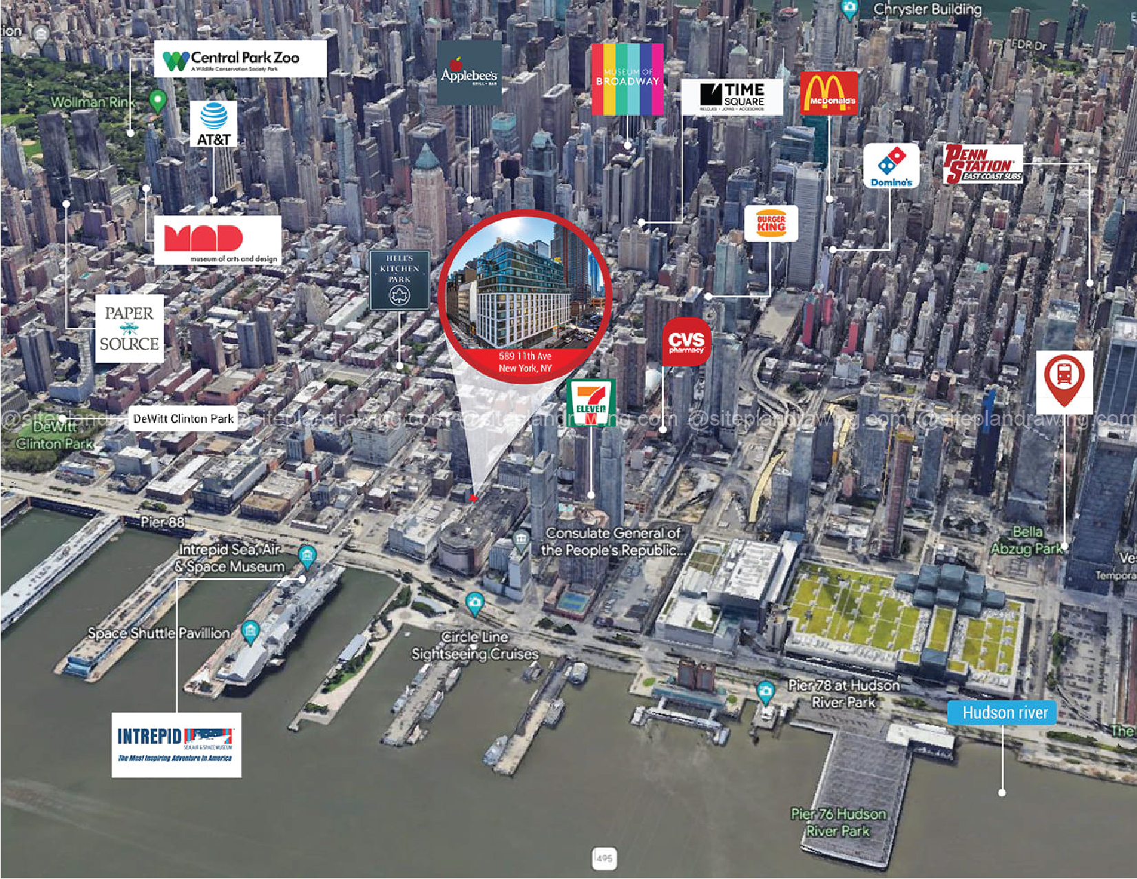
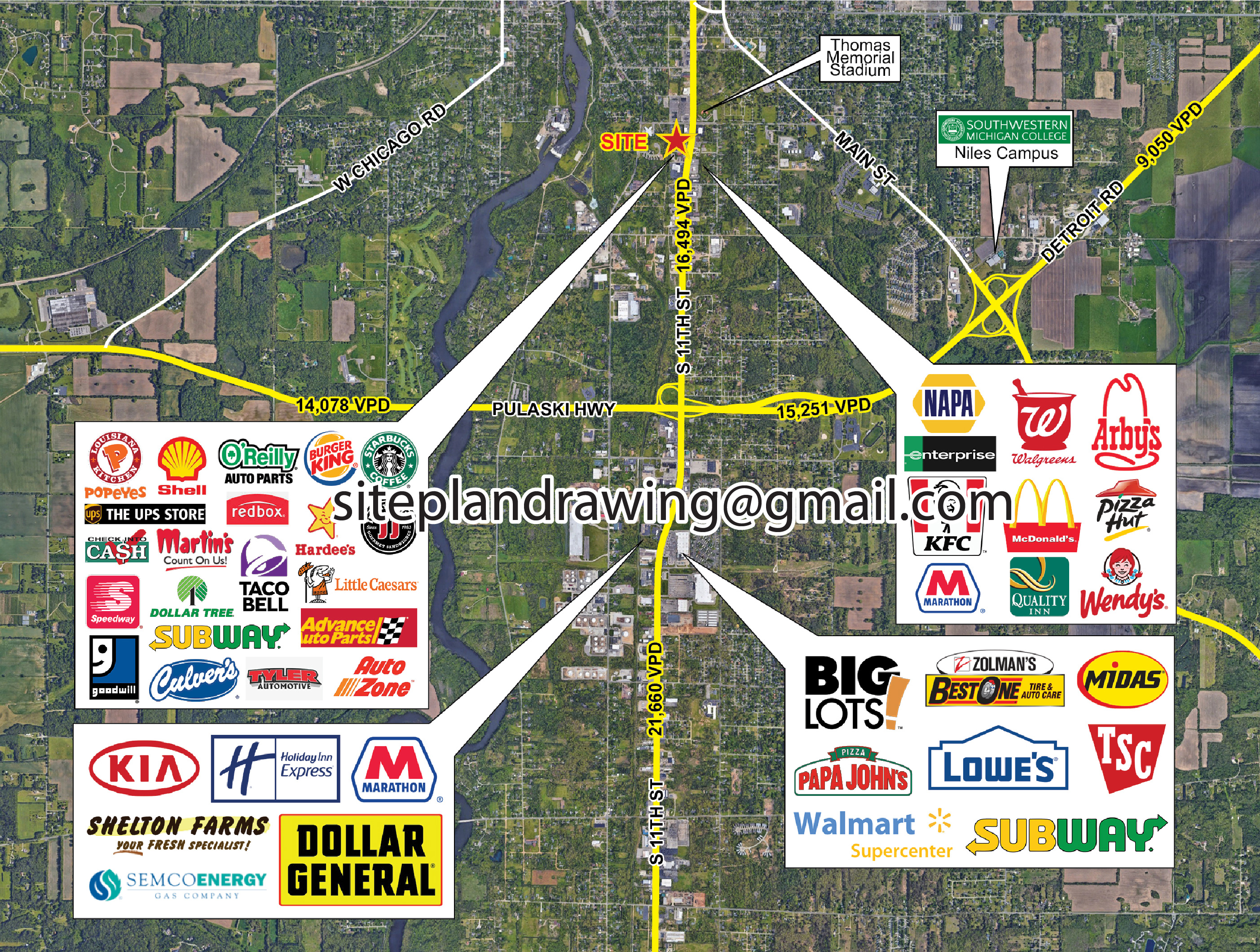
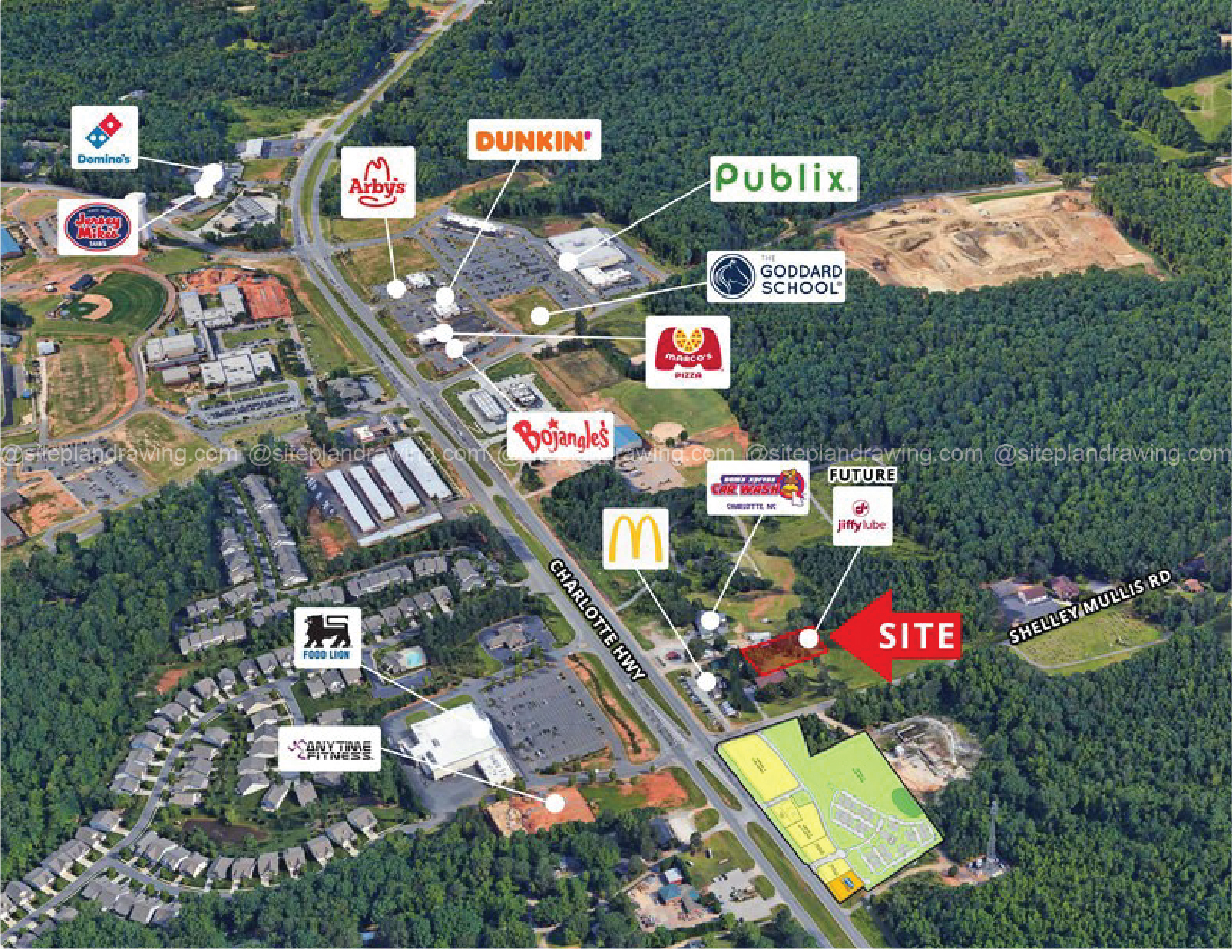
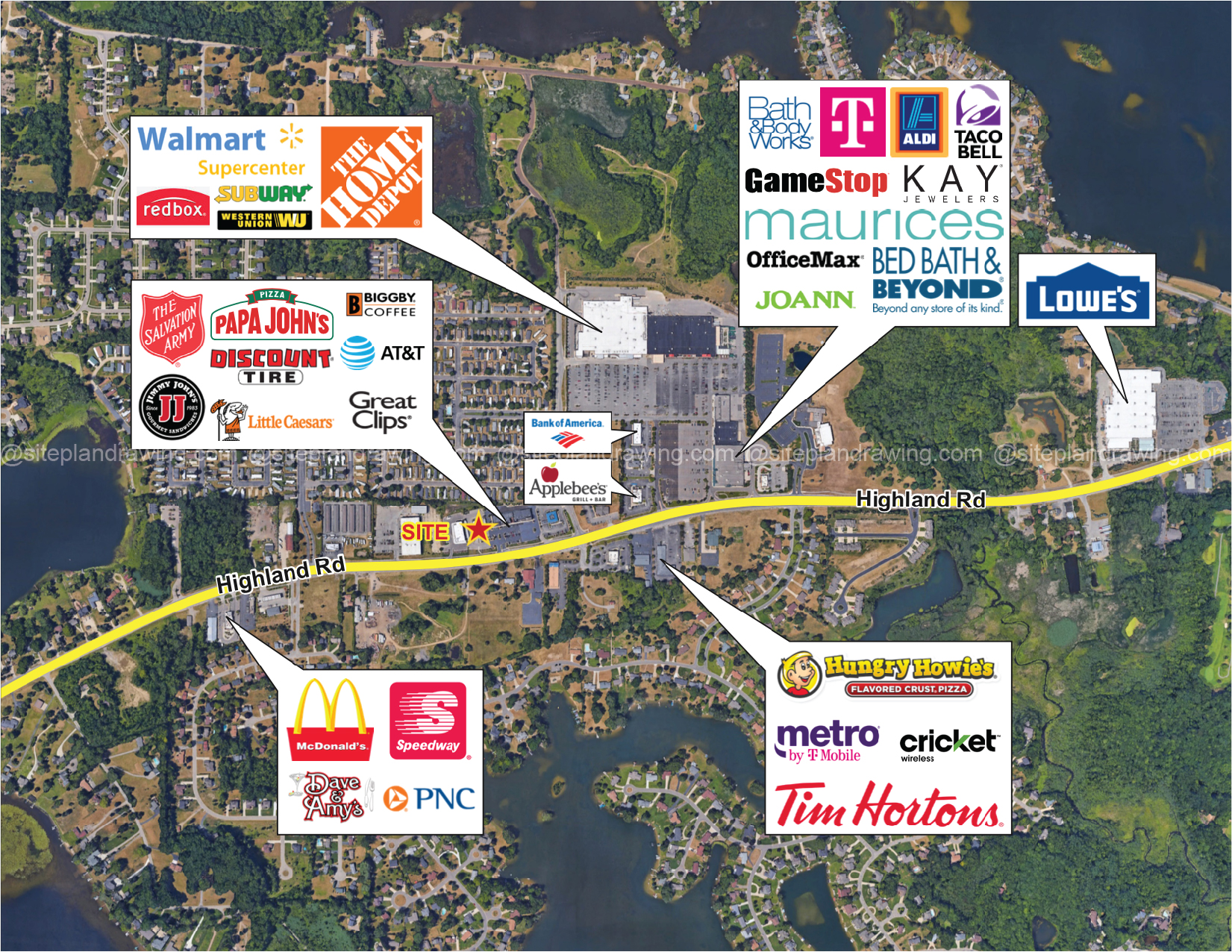
- Location-Focused Clarity – Clearly mark property boundaries, landmarks, transportation links, and selling points.
- Real Estate Marketing Expertise – Tailored for developers, real estate agents, and planners in the U.S. property market.
- Fast Turnaround – Standard 3–5 day delivery, with rush options available.
Perfect For:
- Real estate marketing brochures & flyers
- Development and planning proposals
- Resort, hotel, and community marketing
- Land sales and subdivision promotions
- Urban design, zoning, and masterplan visuals
From Basic Photos to Standout Maps
From simple aerial property outlines to fully customised real estate maps with detailed annotations, we create designs that make your location impossible to overlook.
Get Your Custom Marketing Map Today — and make your property location unforgettable.
Three free modification requests are permitted for this service. If additional modifications are required, charges may apply.
Property Aerial
2 DIMENSIONAL $50We offer maps with minimal details, perfect for small areas or showcasing property location and the surrounding area.
Large/Detailed
2 DIMENSIONAL $80This service is for maps that are more detailed, have more roads, or cover a wider area. We provide personalised labelling, and we can pinpoint any unique places of interest you m…